STABLY
도입 문의Get in touch

사람 대신,
드론을 위험한 현장으로.
We fly where people
shouldn't have to go.

산업 현장을 위한 자율비행 드론.
현장에 맞춰 빠르게, 소량도 맞춤 제작합니다.
Autonomous drones for industrial sites.
Built fast to fit your site, even in small batches.

도입 문의하기Get in touch

Industrial sites are hostile to ordinary drones.산업 현장은 드론에게 극도로 적대적인 환경입니다

혹시 검토하고 계신 현장이 아래 중 하나라도 해당되나요?
그렇다면 일반적인 드론으로는 어렵습니다.
Does the site you're considering look like any of these?
If even one applies, off-the-shelf drones won't cut it.

무인 순찰 현장 / Unmanned patrol

사람 없는 자율비행Autonomy, not a pilot

예시: 인력 절감을 목표로 드론을 검토하는 현장e.g. Teams adopting drones to cut headcount

사람 없는 자율비행Autonomy, not a pilot

인력 절감을 목표로 한다면, 사람이 직접 조종해야 하는 드론으로는 목표 달성이 어렵습니다. 비행마다 숙련된 조종 인력이 한 명씩 필요하기 때문이죠.If the goal is cutting labor, a piloted drone won't get you there. Every flight still ties up a trained operator.

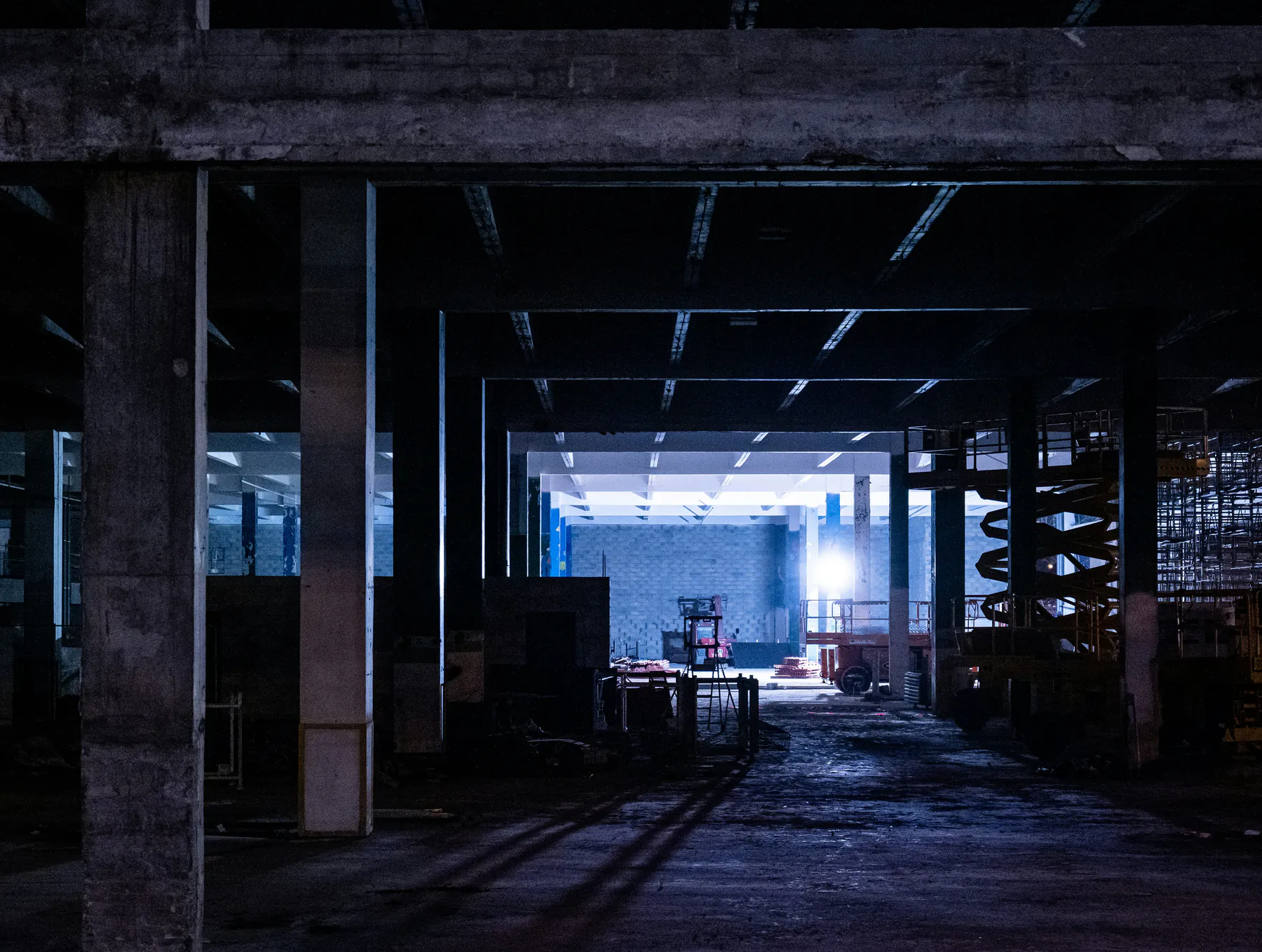
선박 탱크·블록 내부 / Inside ship tank

실내·밀폐 공간Indoors and enclosed

예시: 선박 블록·탱크 내부, 발전소 보일러·터빈실, 공장 설비동, 건설 지하층e.g. Ship tanks, boiler and turbine halls, plant bays

실내·밀폐 공간Indoors and enclosed

일반적인 드론은 GPS가 잡히고 움직일 공간도 넉넉하다는 걸 전제로 만들어집니다. 사방이 막힌 실내나 밀폐 공간에서는 그 두 가지가 모두 없어 안정적인 비행이 어렵습니다.Typical drones assume GPS coverage and room to maneuver. Fully enclosed spaces offer neither, so stable flight is hard.

철골 구조물 내부 / Inside steel structure

GPS 신호 차단No GPS

예시: 실내 작업 공간, 지하 구조물,
대형 철 구조물에 둘러싸인 구역
e.g. Indoor areas, underground structures, zones ringed by steel

GPS 신호 차단No GPS

GPS는 실내뿐 아니라, 겉보기엔 트여 있어도 큰 철 구조물에 둘러싸인 곳에서는 신호가 약해지거나 반사되어 부정확해집니다. 이런 곳에서는 드론이 자기 위치를 인식하기 어려워 안정적인 비행이 어렵습니다.GPS fails outdoors too. Around large steel structures the signal weakens or reflects, so the drone cannot pin down its own position.

대형 금속 설비 / Heavy metal equipment

나침반(자력계) 교란Magnetic interference

예시: 철판·철골 구조물, 대형 금속 설비 주변e.g. Steel structures, near heavy metal equipment

나침반(자력계) 교란Magnetic interference

드론은 보통 방향을 잡기 위해 나침반 역할을 하는 센서(자력계)를 사용합니다. 그런데 철판이나 큰 금속 설비 주변에서는 자기장이 왜곡되어 이 센서가 잘 작동하지 않아 안정적인 비행이 어렵습니다.Drones find their heading with a magnetometer, essentially a compass. Steel and heavy machinery distort the field, so the reading drifts.

천장 크레인 와이어 / Overhead crane wires

탐지하기 어려운 장애물Hard-to-detect obstacles

예시: 천장 크레인 와이어, 가는 배관·전선, 비계e.g. Overhead crane wires, thin pipes and cables

탐지하기 어려운 장애물Hard-to-detect obstacles

공중에 매달려 있는 천장 크레인 와이어처럼 가늘고 흔치 않은 장애물은 탐지하기가 매우 까다롭습니다. 일반적인 드론들은 이런 장애물까지 인식하고 피하도록 설계·검증되어 있지 않아, 충돌 위험이 큽니다.Thin obstacles like suspended crane wires are very hard to see. Typical drones are not built or tested to spot them, so collisions follow.

변화하는 건설 현장 / Changing construction site

매일 바뀌는 현장A site that changes daily

예시: 공정 진행·자재 이동으로 구조가 계속
변하는 현장
e.g. Sites where work and materials
keep moving

매일 바뀌는 현장A site that changes daily

많은 자율비행 드론들은 현장을 미리 3D 지도로 만들어 두고 그 지도를 따라 비행합니다. 하지만 산업 현장이 공정과 자재 이동에 따라 매일 바뀐다면, 미리 만든 지도는 실제 현장에서 사용하기 어렵습니다.Many autonomous systems map the site in 3D first, then fly that map. When work and materials shift daily, a map made in advance stops matching.

그래서, 맞춤형입니다. So we build to fit.

똑같은 현장은 없습니다. 그러니 똑같은 드론도 없습니다.
Stably는 현장, 미션, 목표에 맞게 빠르게 드론을 설계하고 제조합니다. 소량도 가능합니다.
No two sites are the same, so no two drones should be either. Stably designs and builds each drone to fit your site, mission, and goals, fast. Small batches, too.

자율비행 순찰 드론 프로토타입Autonomous patrol drone prototype

자율 임무 수행Autonomous missions

자동 이륙·비행·착륙, 이상 시 자동 귀환Auto takeoff, flight, landing; auto return on fault

3D LiDAR SLAM3D LiDAR SLAM

위성 신호·자력계 없이 위치·속도 추정Position and velocity without GNSS or magnetometer

사전 인프라 불필요No prior infrastructure

지도·마커·반사판 설치 없이 즉시 투입No maps, markers, or reflectors to install

장애물 회피Obstacle avoidance

직경 10mm 철사까지 실시간 인식Real-time detection down to 10 mm wire

조명 탑재Onboard lighting

전면 고휘도 LED, 임무 중 점등·소등High-output front LEDs, switchable mid-mission

점검 데이터 취득Inspection data

3D 포인트클라우드 + 카메라·센서 데이터3D point cloud plus camera and sensor data

조립식 드론 분해도 / Exploded view

순찰용 드론Patrol drone

공사 현장에서의 화재 예방 / 보안을 위한 야간 순찰을 무인화하는 드론입니다.A drone that automates night patrols for fire prevention and security at construction sites.

다목적 드론Multi-purpose drone

벽을 따라 구르는 구조를 활용하면 좁은 공간과 벽면 밀착 작업까지 가능합니다. 점검, 측정, 운반, 도색 등 다양하게 활용 가능합니다.Its wall-rolling structure lets it fly in tight spaces and work flush against walls. It can be used for inspection, measurement, transport, coating, and more.

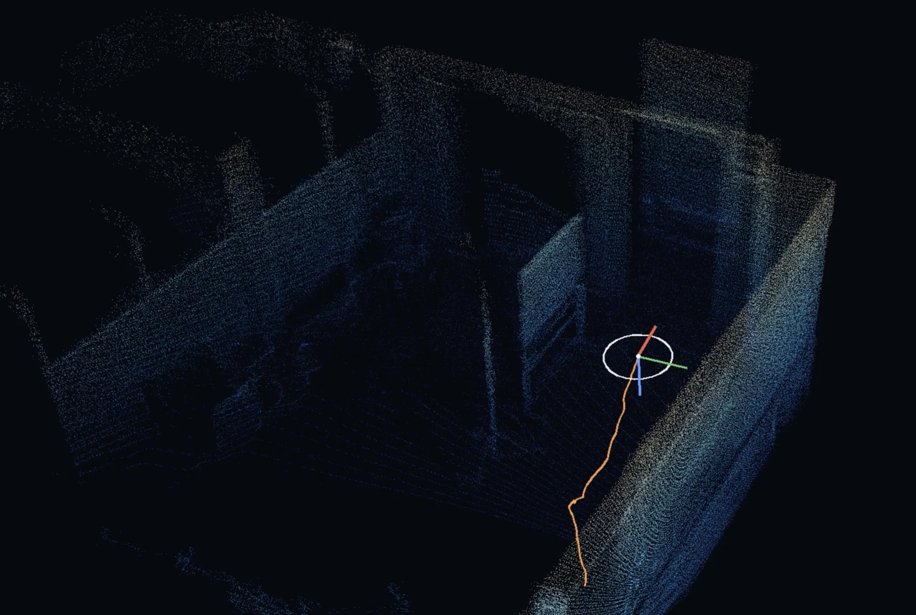
자체 개발 3D LiDAR SLAM이 만든 실내 구조물 포인트 클라우드 지도와 드론의 위치·궤적 / Point-cloud map built by Stably's 3D LiDAR SLAM, showing the drone's pose and trajectory

자체 개발
3D LiDAR SLAM
In-house
3D LiDAR SLAM

SLAM이란 주변을 측정해 지도를 만들면서, 그 지도 위에서 자기 위치를 동시에 찾는 기술입니다. GPS가 닿지 않는 공간에서 드론이 위치와 속도를 파악하는 핵심 수단입니다. SLAM builds a map of the surroundings while locating itself within that map at the same time. It is how a drone knows its position and velocity where GPS cannot reach.

공개된 LiDAR SLAM은 대부분 핸드헬드 스캐너나 지상 로봇을 전제로 합니다. 드론용은 목표가 다릅니다. 순간순간의 떨림, 곧 고주파 대역을 잡아야 합니다. 이 대역의 오차가 크면 드론은 자기 떨림을 실제 움직임으로 오인해 보정하려 들고, 진동과 부유가 생깁니다. 협소한 구간에서는 곧바로 충돌로 이어질 수 있습니다. Most published LiDAR SLAM assumes a handheld scanner or a ground robot. Drones need something different: tracking the high-frequency band, the moment-to-moment tremor. Large errors there make a drone read its own shake as real motion and correct for it, producing vibration and drift. In tight spaces that can lead straight to a collision.

저희는 드론 비행제어를 목표로 알고리즘을 새로 개발했고, 공개된 알고리즘 대비 고주파 대역 추정 오차가 적게는 2.5배, 많게는 17배 낮았습니다. We built ours for drone flight control, measuring 2.5× to 17× lower high-frequency estimation error than published algorithms.

※ 비교 대상 — KISS-ICP (2023), MAD-ICP (2024), GenZ-ICP (2025) ※ Benchmarked against KISS-ICP (2023), MAD-ICP (2024), GenZ-ICP (2025)

부품부터 알고리즘까지,
전 계층을 함께 설계합니다.
From components to algorithms,
every layer designed together.

기체 설계·제작, 비행제어 펌웨어, SLAM과 자율비행 알고리즘, 임무 소프트웨어까지
전 과정을 직접 개발하고 검수합니다.
Airframe, flight firmware, SLAM and autonomy, mission software:
every layer is built and verified in-house.

핵심 부품은 최신 세대 최상위 등급으로 구성했습니다. 부품을 갖췄다고 성능이
나오지는 않습니다. 그 위에서 도는 펌웨어와 알고리즘이 그 구성에 맞춰 설계되어야 합니다.
Every core component is newest-generation, top-tier. Good parts alone do not make
a good drone: the firmware and algorithms above them must be designed around that hardware.

자체 비행제어 펌웨어Our flight firmware

PX4 대비 코드 99.6% 감축99.6% less code than PX4

범용 오픈소스 대신 필요한 기능만 구현했고, 그 과정에서 비행제어 알고리즘도 함께 개선했습니다.Only what we need, instead of a general-purpose stack, and the control algorithm improved along the way.

비행 컨트롤러 연산 성능Flight controller compute

주류 칩 대비 2.3배2.3× the mainstream chip

2025년 출시된 최신 세대를 쓰고, 펌웨어를 직접 만들었기에 이 성능을 끝까지 끌어 씁니다.A 2025-generation part, and because the firmware is ours we use all of it.

3D LiDAR 측정 범위3D LiDAR field of view

반구 전체 187°187°, a full hemisphere

기체 바로 위 천장까지 사각지대가 없습니다. 널리 쓰이는 소형 LiDAR와 무게는 비슷합니다.Nothing is blind even directly overhead, at about the weight of the compact LiDARs in common use.

기술 자산Research and IP

특허 출원·등록 6건6 patents filed or granted

「3D 프린팅을 이용한 모듈형 드론 구조체」, 「벽면 등에 밀착하여 비행할 수 있는 구조를 가진 드론」 등 "Modular drone structure using 3D printing", "Drone with a structure that can fly flush against walls", and more

AI 안전성 원천기술AI safety research

드론을 포함한 산업현장 문제 해결에 폭넓게 적용할 수 있습니다. Applies broadly across industrial sites, not just drones.

arXiv:2504.20924

도입 · PoC 문의 Get in touch

도입 검토나 PoC 진행을 원하시면 편하게 연락 주세요. 현장 환경에 맞춰 상담해 드립니다. If you're considering adoption or a PoC, feel free to reach out.
We'll talk through what fits your site.

ys.shin@stably.kr